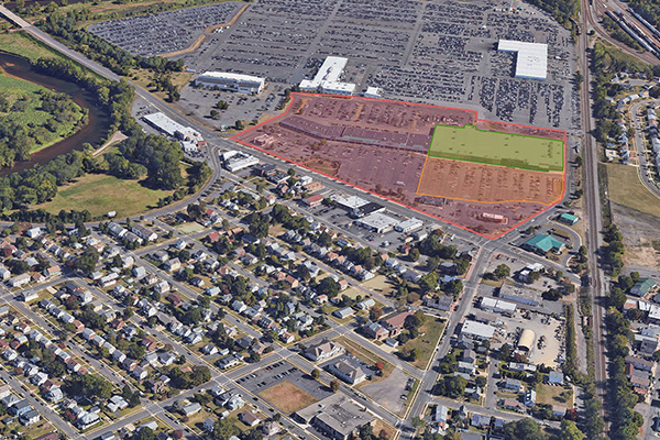
There are several ways to set up geofencing around a location, each with varying levels of accuracy for measuring visitors to stores. The most basic method of location-based geofencing is called radius geofencing and is generally performed by placing a radius around a place’s address. This can be improved by placing a radius around geo-codes instead, which places a radius around the center of a business location. However, the issue with both of these methods is most locations are not circular, so radius geofencing often leads to wasted ad spend.
Another way to set up geofencing is by tapping into parcel maps, which are widely used property boundaries and are popular data sources for industries such as real-estate. While more effective, a parcel map often includes several businesses within that location.
The most effective way to set up a geofence is called polygon mapping, where a boundary is traced around the store or point of interest.
While there are several different types of geofencing options, which one you set up is often correlated to your goals. GroundTruth Ads Manager makes it easy for advertisers to set a geofence, whether performed by polygon mapping through its proprietary mapping technology called Blueprints or by placing a radial fence around a location.
